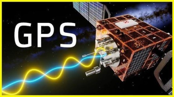
How GPS Works: A Beginner's Guide to Global Positioning System Technology
The Global Positioning System (GPS) is a satellite-based navigation system that allows devices to determine their precise location almost anywhere on Earth. From smartphones and car navigation systems to aircraft, ships, delivery vehicles, and fitness trackers, GPS helps billions of devices provide accurate positioning, navigation, and timing information.
Although getting directions or tracking your location feels instantaneous, GPS relies on a sophisticated network of satellites, ground stations, and receivers working together in real time.
What Is GPS?

GPS is a global satellite navigation system that enables receivers to calculate their location, speed, and time by receiving signals from multiple satellites orbiting Earth.
Originally developed for military use, GPS is now widely available for civilian applications around the world.
How GPS Works
GPS determines your location through a series of coordinated steps.
Step 1: GPS Satellites Orbit Earth
A constellation of at least 24 operational satellites—with additional backup satellites—circles the Earth in medium Earth orbit. These satellites continuously broadcast signals containing their precise location and highly accurate timestamps generated by onboard atomic clocks.
Step 2: Your Device Receives Satellite Signals
A GPS receiver in your smartphone, smartwatch, vehicle, or navigation device listens for signals from nearby satellites. To calculate a three-dimensional position accurately, it typically needs signals from at least four satellites.
Step 3: Measuring Signal Travel Time
The receiver calculates how long each satellite signal took to reach it. Because radio waves travel at the speed of light, the receiver can estimate its distance from each satellite.
Step 4: Trilateration Calculates Your Position
Using the measured distances from multiple satellites, the receiver performs a mathematical process called trilateration. The point where the distance measurements intersect reveals the receiver's latitude, longitude, altitude, and highly accurate time.
Step 5: Location Is Displayed
The calculated position is combined with digital maps and navigation software to provide directions, estimated travel times, and other location-based services.
This entire process is repeated continuously, allowing your device to update your location in real time.
Key Components of the GPS System
Several elements work together to provide GPS services.
GPS Satellites
Satellites continuously transmit positioning and timing signals to receivers on Earth.
Ground Control Stations
Ground stations monitor satellite health, update orbital information, and maintain system accuracy.
GPS Receiver
A receiver in a smartphone, vehicle, drone, or other device processes satellite signals to determine location.
Atomic Clocks
Extremely precise atomic clocks aboard GPS satellites provide accurate timing, which is essential for precise positioning.
Mapping Software
Navigation applications use GPS coordinates together with digital maps to guide users.
Why GPS Needs Four Satellites
Each satellite provides one distance measurement.
- One satellite: Possible location lies somewhere on a sphere.
- Two satellites: Narrows the position to a circular intersection.
- Three satellites: Determines a possible location on Earth's surface.
- Four or more satellites: Corrects timing errors in the receiver and calculates an accurate three-dimensional position.
Using more than four satellites can further improve positioning accuracy.
Factors That Affect GPS Accuracy
Several conditions influence GPS performance.
Satellite Visibility
Open skies provide stronger and more reliable satellite signals.
Buildings and Urban Areas
Tall buildings can block or reflect signals, reducing accuracy—a phenomenon often called the "urban canyon" effect.
Trees and Mountains
Dense vegetation and natural obstacles may weaken satellite reception.
Atmospheric Conditions
Signals passing through the ionosphere and atmosphere can experience slight delays that affect positioning.
Receiver Quality
Modern GPS chipsets use improved antennas and advanced signal processing to enhance accuracy.
Common Applications of GPS
GPS supports countless everyday activities.
Navigation
Provides turn-by-turn directions for drivers, cyclists, pedestrians, and public transportation users.
Aviation
Pilots use GPS for navigation, flight planning, and route management.
Maritime Navigation
Ships use GPS for positioning, navigation, and route optimization.
Emergency Services
First responders use GPS to locate incidents and improve response times.
Logistics
Delivery companies track vehicles, optimize routes, and monitor shipments.
Agriculture
Farmers use GPS-guided equipment for precision planting, fertilization, and harvesting.
Fitness and Sports
Smartwatches and fitness trackers record distance, speed, routes, and workout performance.
Benefits of GPS
GPS offers numerous advantages.
Accurate Positioning
Provides precise location information almost anywhere in the world.
Real-Time Navigation
Guides users with continuously updated directions.
Improved Safety
Supports emergency response, disaster management, and search-and-rescue operations.
Greater Efficiency
Optimizes transportation routes, fleet management, and logistics operations.
Precise Timing
GPS timing is also used to synchronize telecommunications networks, financial systems, and power grids.
Challenges of GPS
Despite its capabilities, GPS has several limitations.
Signal Blockage
Indoor environments, tunnels, and underground areas may block satellite signals.
Weather and Atmospheric Effects
While GPS generally works in most weather conditions, atmospheric disturbances can slightly reduce accuracy.
Battery Usage
Continuous GPS tracking can increase battery consumption on mobile devices.
Security Risks
GPS signals can be vulnerable to interference, jamming, or spoofing in certain situations.
Best Practices for Using GPS
Users should follow these recommendations.
Keep Location Services Updated
Use the latest device software and mapping applications.
Allow Clear Sky Access
GPS performs best when the receiver has an unobstructed view of the sky.
Enable High-Accuracy Mode
Many smartphones combine GPS with Wi-Fi and mobile network positioning for faster and more accurate location services.
Download Offline Maps
Offline maps can provide navigation when mobile internet coverage is limited.
Manage Battery Usage
Disable continuous location tracking when it is not required to conserve battery life.
Future of GPS
GPS technology continues to evolve through multi-constellation satellite navigation, Artificial Intelligence, 5G connectivity, autonomous vehicles, precision agriculture, drones, and smart city infrastructure. Modern devices increasingly combine GPS with other global navigation satellite systems (GNSS), such as Europe's Galileo, Russia's GLONASS, China's BeiDou, and Japan's QZSS, to improve accuracy, reliability, and availability. As positioning technologies advance, GPS will remain essential for transportation, logistics, emergency services, IoT, and next-generation autonomous systems.
Conclusion
The Global Positioning System is one of the most important technologies behind modern navigation and location-based services. By receiving signals from multiple satellites and using trilateration to calculate precise positions, GPS enables everything from smartphone navigation and fitness tracking to aviation, agriculture, and emergency response. As satellite technology and positioning systems continue to improve, GPS will remain a vital part of our increasingly connected world.